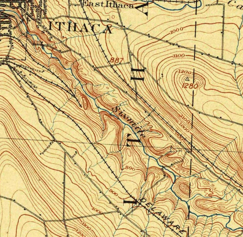
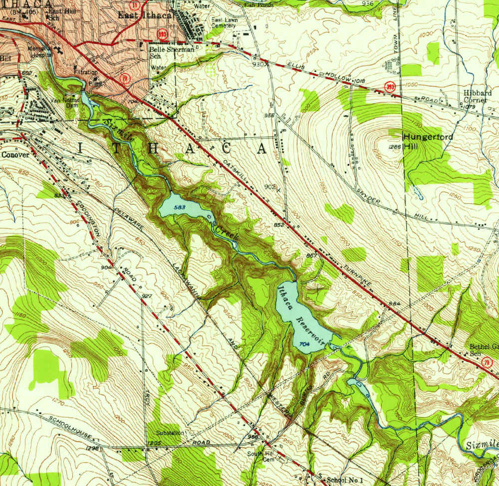
Six Mile Creek has three reservoirs which have served the City of Ithaca: behind Van Nattas Dam, the 30 Ft. Dam, and the 60 Ft. Dam. The USGS topological map for the Dryden Quadrangle from 1900 shows only the reservoir behind the Van Nattas Dam. The others can be seen by sliding the control to the 1949 topo map. The engineers took advantage of existing gorges to minimize the width of the dams.
The 1900 map is quite inaccurate by today's standards. For instance, the narrow gorge at the 60 Ft. Dam doesn't appear. Features that do appear are not where they are found in the later map.
The 1900 map has been rotated and translated to keep the stream beds in the two maps as close as possible. You can judge the extent of the rotation by comparing the Town of Ithaca boundry (the vertical dotted line towards the right side of the maps).
Another interesting detail is the old Delaware, Lackawana & Western Railroad switchback on South Hill, which appears on both maps. The old rail bed is now the South Hill Recreation Way.